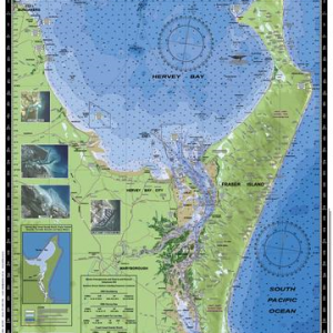
Size 61x88cm
BONUS WALL CHART – Coastal Fish and Animals of Australia reverse side
Features
- Water contours are shades of blue becoming progressively darker as depth increases
- Land contours become progressively darker as height increases
- Natural features, reefs,mangroves, sand types, mud, salt pans and others features are visually realistically depicted
- Grid reference system simplifies identifying positions for boating, fishing and rescue services
- Marine Emergency Search and Rescue contact details for Police and Volunteer Rescue Services phone numbers including radio frequencies monitored are easily located on the chart
- Navigation symbolsare clearly explained on the chart without the need for supplementary handbook
- Known information such as names, heights, depths, seabed, GPS marks, obstructions and navigational tracks included
- Satellite positions derived from the WGS1984 datum can be plotted directly onto this chart
- No fishing Zones, officially declared Smooth, Partially smooth, Open waters zones clearly indicated
- Lesser known information such as local knowledge of fishing and diving locations, local common names and information from latest satellite images are included at time of publication
- An affordable chart and perfect gift or reference guide both at home or on holidays


 CAMTAS Charts
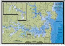 CAMTAS Charts
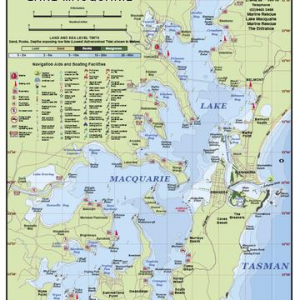 CAMTAS Charts